
This case study covers a Matterport 3D scanning project at 6 Parade Gardens in central Bath, where the scans were used for renovation planning, council approvals, and measuring rather than property marketing. The project included scanning the main property and the historic vaulted cellars beneath the restaurant. Matterport scans are not just for finished properties. They are widely used for pre-renovation documentation, construction progress recording, dilapidation surveys, and heritage recording. The 3D model allows architects, builders, and planning officers to take measurements and walk through the space virtually without repeated site visits. Matterport scanning in Bath starts from £200-£500 depending on property size and complexity.
When most people think of Matterport 3D scanning, they picture finished properties, beautifully staged homes ready for sale, or polished holiday lets waiting for their next guests. But that is only half the story. Matterport is just as valuable, sometimes more so, as a planning and documentation tool for properties that are about to change rather than properties that are ready to show off.
This case study covers a Matterport scanning project in central Bath for a property undergoing a complete renovation. The scans were commissioned not for marketing, but for project planning, council planning approvals, and to provide accurate measurements for the renovation works ahead. The project also included scanning the historic vaults beneath the building's restaurant, spaces that are difficult to photograph conventionally and almost impossible to convey through traditional floor plans alone.
01The Brief
The client owned a property in central Bath that was about to undergo a significant renovation. Before any work began, they needed a complete, accurate digital record of the existing building in its current state. This would serve multiple purposes: providing the architects and builders with precise measurements without repeated site visits, giving the council planning team a clear visual record of the existing layout for planning applications, and creating a baseline document that could be referenced throughout the project.
The property included a restaurant at ground level with historic vaulted cellars beneath, and residential space above. Each area needed scanning separately to create a comprehensive digital twin of the entire building.
02Why Matterport for Renovation Planning
Traditional approaches to documenting a property before renovation involve a combination of photographs, hand-drawn sketches, and measured surveys. Each of these has limitations. Photographs show what a space looks like but give no sense of spatial relationships or accurate dimensions. Sketches are only as good as the person drawing them. Measured surveys are accurate but expensive and produce flat 2D drawings that can be difficult for non-technical stakeholders to interpret.
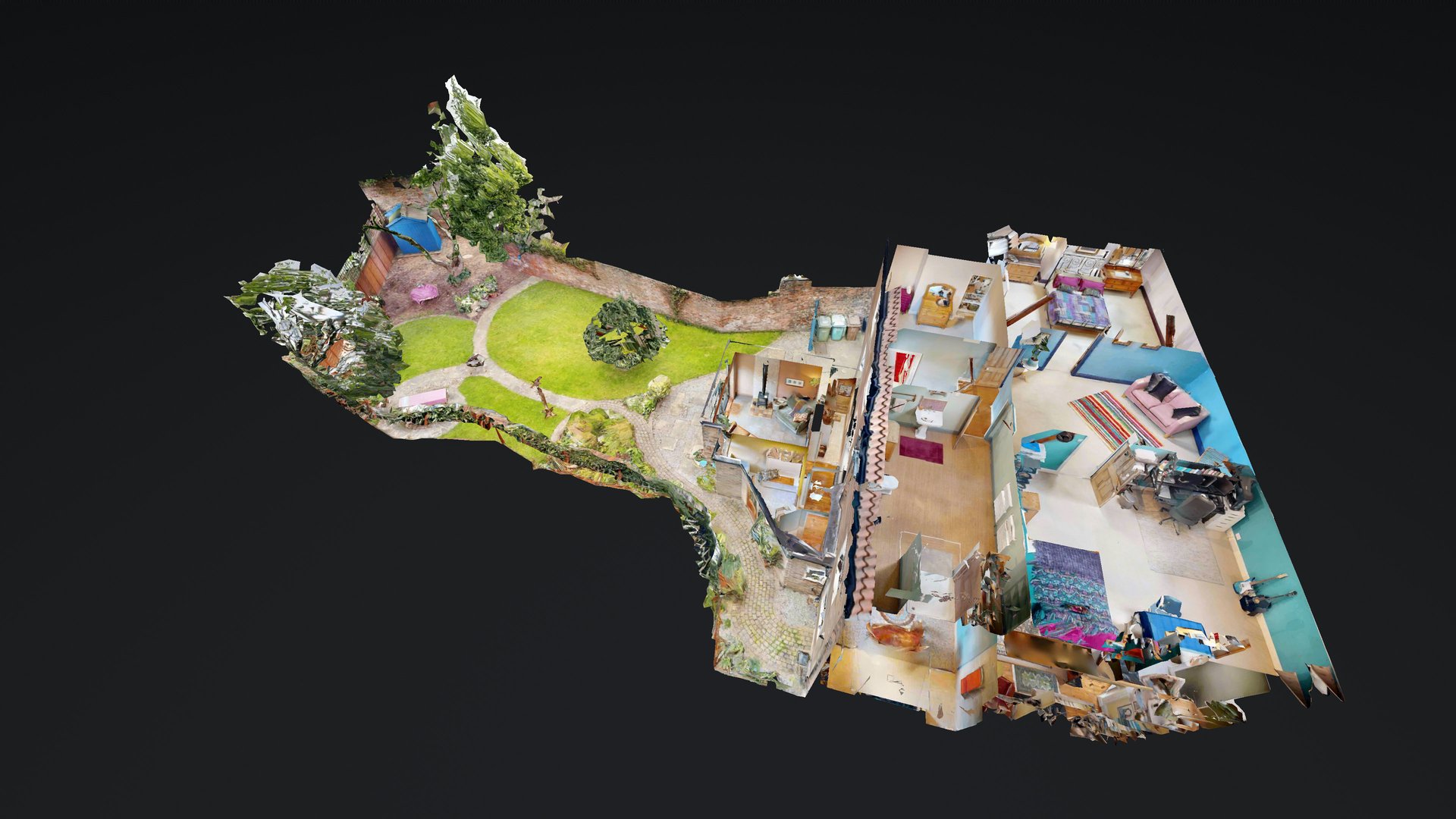
A Matterport scan combines all three into a single deliverable. The 3D model allows anyone, from the architect to the council planning officer to the builder, to walk through the space virtually, take measurements directly from the model, and understand the spatial relationships between rooms, floors, and structural elements. For a complex renovation where multiple parties need to understand the existing building, this is significantly more efficient than sending each person to site individually.
03The Main Property Scan
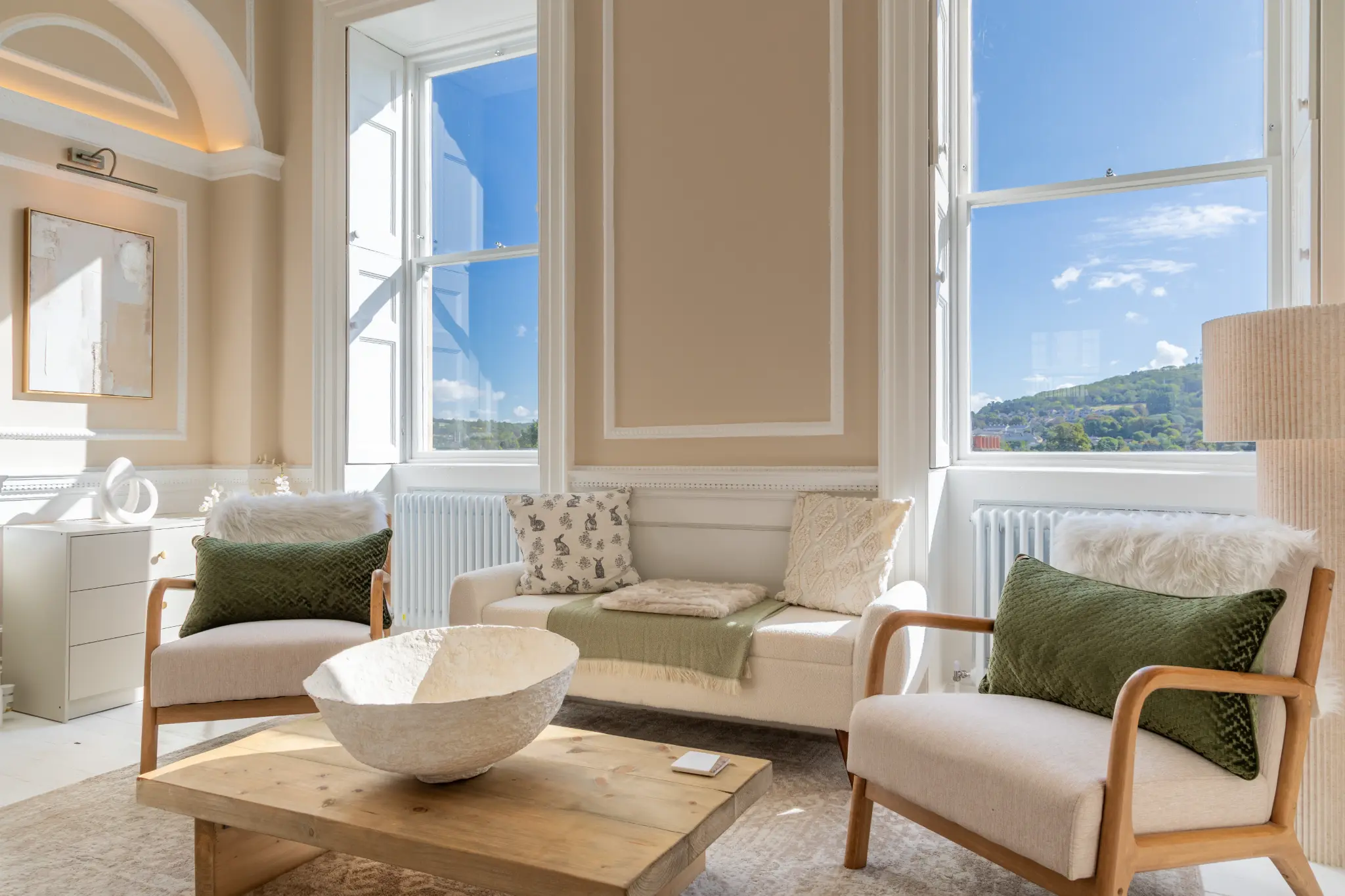
The main property scan captured the full building across multiple floors, documenting every room, corridor, staircase, and structural feature in its current state. The scan provides a complete walkthrough that anyone with a web browser can navigate, zooming in on details, measuring distances between walls, and understanding how the spaces connect.
For the renovation team, this scan became the primary reference document. Rather than scheduling site visits every time a question arose about a dimension, a ceiling height, or the position of a structural wall, the team could simply open the scan and find the answer immediately. Over the course of a complex renovation, this saves considerable time and reduces the risk of costly errors.
04The Restaurant and Vaults
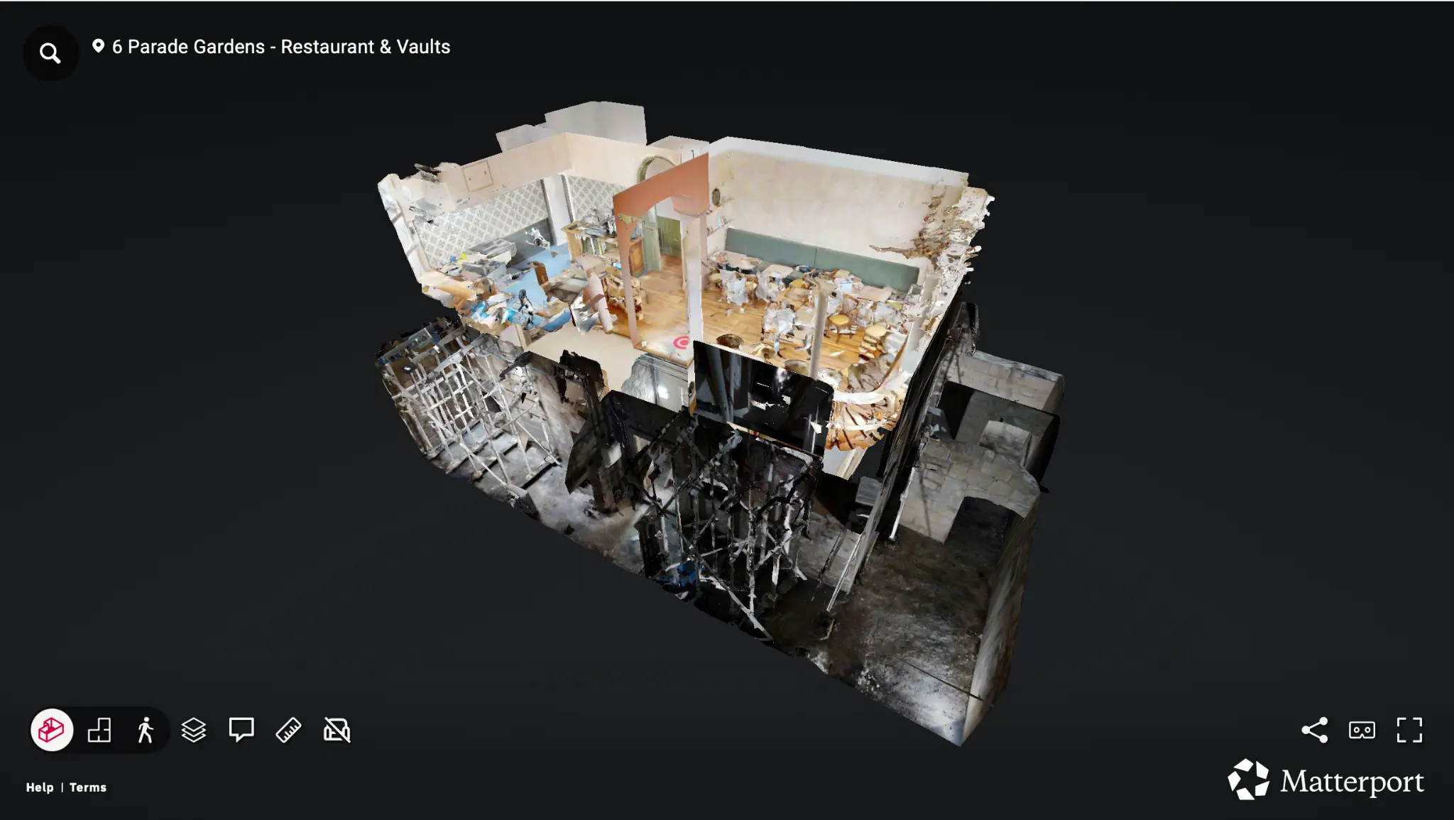
Below the main property sits a restaurant with historic vaulted cellars, spaces that present a unique challenge for documentation. Vaulted ceilings, curved walls, and irregular floor levels are extremely difficult to capture accurately with traditional measurement methods. A tape measure and spirit level are designed for straight lines and right angles, not for 18th-century stone arches.
The Matterport Pro 3 camera handles these irregular spaces well because it captures the geometry of the space as it actually is, not as a simplified 2D representation. The vaulted ceilings, the stone pillars, the uneven floor levels, all of these are preserved in the 3D model with millimetre accuracy. For the architects working on the renovation, this level of detail is invaluable when designing interventions that need to work with, rather than against, the existing structure.
05Client Feedback
"Absolutely incredible work — I only wish I'd found Matthew sooner, it would have saved so much time and money. We had a very challenging Matterport scanning project across a 14-room, 6-floor, 375-year-old building, and Matthew approached every detail with patience and precision to get the result absolutely perfect. Exceptional service from start to finish. Highly recommended."
06Matterport for Council Planning Applications
One of the most practical applications of this scan was supporting the council planning application. Planning officers need to understand the existing building before they can assess proposed changes, and traditionally this means reviewing 2D drawings, photographs, and written descriptions. A Matterport scan gives them something far more useful: the ability to virtually walk through the building themselves, understanding the spatial context of proposed changes in a way that flat drawings simply cannot convey.
For listed buildings or properties in conservation areas, where the council needs to understand the heritage value of existing features before approving alterations, this is particularly powerful. The scan captures every architectural detail, every original feature, every structural element, creating an indisputable record of the building's condition before work begins.
07Not Every Scan Is for a Finished Property
This project is a good example of how Matterport scanning extends well beyond property marketing. The technology is the same, the camera is the same, the process is the same, but the purpose is entirely different. Here, the scan is a working document, a tool for planning, communication, and decision-making rather than a marketing asset.
Other common uses for Matterport scanning beyond finished properties include:
- Pre-renovation documentation for insurance, planning, and project management
- Construction progress recording at key stages throughout a build
- Dilapidation surveys for commercial leases
- Heritage recording for listed buildings and conservation projects
- Insurance claims documentation following damage or loss
- Facilities management for complex buildings with multiple stakeholders
If you are planning a renovation, managing a construction project, or need to document a building for any non-marketing purpose, a Matterport scan is one of the most efficient ways to create a complete, accurate, and shareable digital record.
08Matterport Scanning in Bath
I offer Matterport scanning services across Bath, Bristol, Somerset, and the wider South West. Whether you need a scan for property marketing, renovation planning, council applications, or any other purpose, the process is the same: I visit the property with the Matterport Pro 3 camera, capture the space, and deliver a hosted 3D tour that you can share with anyone via a simple link.
For renovation and planning projects, I can also provide floor plans extracted from the scan, measurement tools for your team, and downloadable point cloud data if your architects need it for CAD integration.
My Matterport virtual tour services cover all applications, from marketing to planning. For Bath-specific pricing and availability, see my dedicated virtual tours in Bath page. For a broader workplace, hospitality or planning-led brief in the city, see my commercial photography in Bath page. Get in touch to discuss your project.
Local coverage: View my property photography and scanning services in Bath for pricing, portfolio, and availability.
Professional Matterport 3D scanning across Bath, Bristol, and the South West. View my Matterport virtual tours or get in touch to arrange a scan.