Photography Services
Choose the service that fits your property or business.
From a standout holiday let to a property sale or commercial space, start with the service that matches the job.
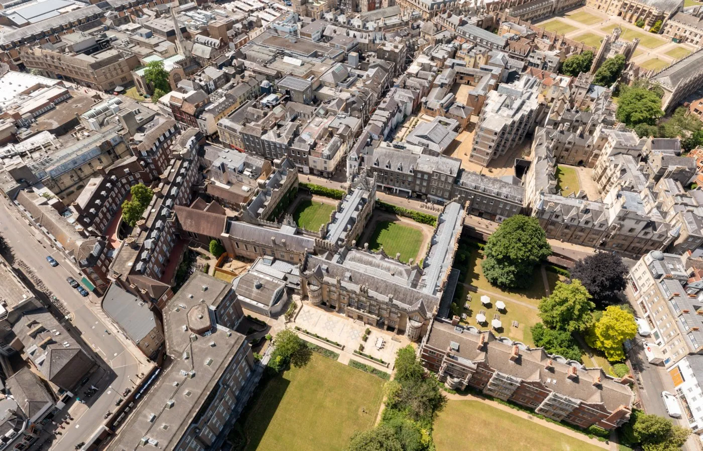
If you have searched for a drone survey in Bristol, you are most likely looking at something you cannot get near: a roof four storeys up on a Clifton terrace, a flat roof on an Avonmouth unit, a parapet above a harbourside facade, or a development site that has changed shape since you last walked it. I am Matthew, a CAA-licensed drone photographer based in Weston-super-Mare, and I fly across Bristol most weeks. What I give you is imagery your surveyor, roofer or architect can work from, not a measured survey and not a report on condition.
Bristol is a more interesting city to fly than most of my patch, and not always in a helpful way. The housing stock is tall and tightly packed, the harbour puts water and public quayside right up against the buildings people want photographed, and there is an airport control zone to the south that has to be respected. That is why every Bristol enquiry starts with me checking the site and the airspace before I quote, so the answer you get is either a fixed price and a date or a straight explanation of why the flight is not possible.
Who needs aerial inspection imagery in Bristol
Four kinds of building account for nearly all of my inspection flying in the city, and they are not the same four I would list for a Somerset market town.
Victorian and Georgian housing stock
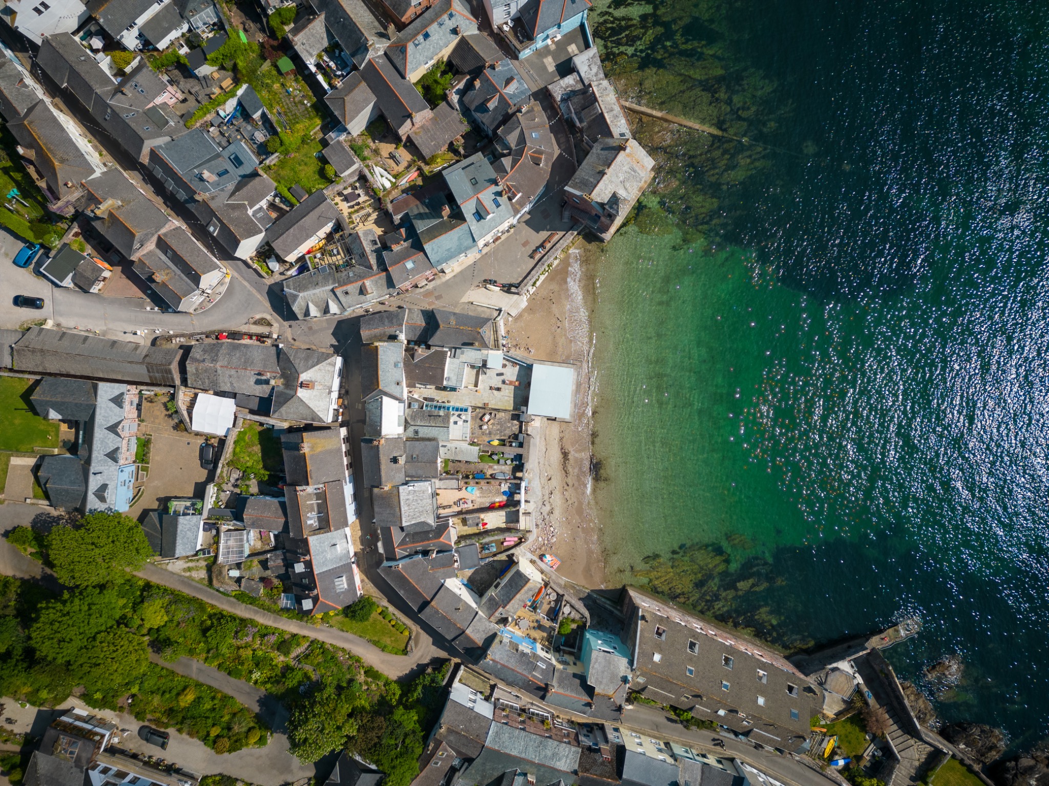
Most of the enquiries I get from Bristol are about roofs on tall period houses. A four-storey Clifton terrace or a Redland villa has a roof nobody has looked at properly in years, often with valley gutters between pitches, parapets at the front and a chimney stack or two still in use. The street view tells you nothing, and a ladder gets you to the gutter at best. Fifteen minutes in the air gets you the slates, the flashing, the ridge, the stack and the rear elevation that no neighbouring window overlooks.
Commercial and industrial premises
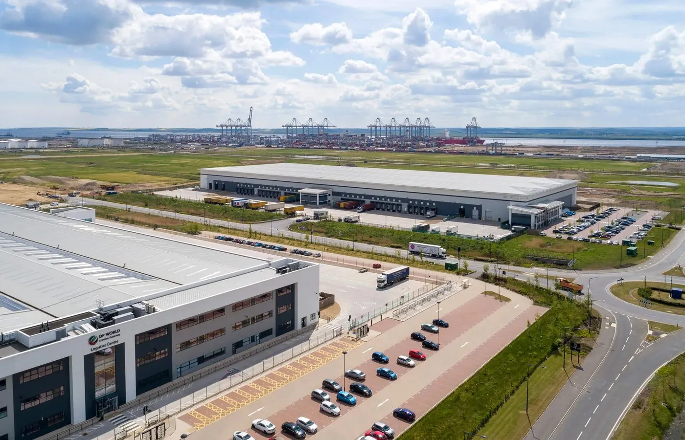
Bristol's trading estates are full of large flat and shallow-pitched roofs, and those are the buildings where aerial imagery earns its keep fastest. Standing in the yard at Avonmouth or St Philips you cannot see a single square metre of the roof you are responsible for. From the air you get the whole membrane, the rooflights, the plant, the gutter lines and the parapet edges in one consistent set, which is usually what a managing agent or a facilities team needs before deciding whether to repair or budget for replacement.
New-build and development sites
The city's build-out along the northern fringe means a steady amount of progress work. I fly repeat visits from matched positions and heights so the sequence lines up month to month, which is what turns a folder of photographs into a record a board or a lender can read at a glance. Plot layouts, road and drainage runs, site compound and phasing all read clearly from above while they are still changing week to week.
Harbourside and listed buildings
Around the harbour and the older centre, access is the whole problem. Buildings sit tight against water, quayside, road or each other, scaffolding means permits and lost trading, and the details people want to see are at high level: cornices, parapets, lead work, render and pointing on facades that face across the water. Aerial imagery gets a clean look at those elevations without touching the fabric of the building, which matters on anything listed.
Flying a drone in Bristol
This is the part of a Bristol job that takes the most thought, and it is worth understanding before you brief anybody. There are three things that decide whether a flight happens: the airport zone, the built-up nature of the city, and whatever temporary restrictions are in force that day.
Bristol Airport's Flight Restriction Zone
Bristol Airport sits south west of the city, and like most UK airports it has a Flight Restriction Zone around it. Inside that zone a drone cannot legally be flown without permission from the airport, whatever the drone weighs. In practice this affects work in the southern approaches to the city and the villages out towards the airport far more than it affects central or north Bristol, but the honest answer for any given address is that it has to be checked rather than assumed. I check each site against the current published airspace restrictions before quoting, because the geo-awareness data built into a drone can be out of date and is not a substitute for that check.
Flying in a congested city
Central Bristol, the harbourside and the residential terraces all count as built-up areas under the CAA rules, and this is where the aircraft matters. A heavier drone has to stay 150m clear of residential, commercial, recreational and industrial areas and 50m from uninvolved people, which would rule out most of the city. I fly a sub-249g DJI Mini 5 Pro, and drones under 250g are permitted to fly in those areas and closer to uninvolved people, which is what makes photographing a Redland roof or a harbourside elevation legal at all. The limit that never moves is crowds: no drone of any size is flown over an assembly of people. Height is capped at 120m above the surface, and I keep the aircraft in sight throughout.
Event days and temporary restrictions
Bristol has a busy events calendar, and events change the airspace picture temporarily rather than permanently. Large gatherings and displays are commonly covered by short-notice restrictions and safety notices to airmen, and the balloon fiesta period is the obvious example of a time when there is a great deal of low-level aviation over the city and its northern fringe. My habit is to check current notices for the date as well as the map, because short-notice restrictions do not always appear on the standard zone map, and to move a flight by a day rather than fly into a busy piece of sky.
Ground-level permissions
Airspace is only half of it. I still need the landowner's permission for the spot I take off and land from, which in central Bristol often means a private yard, a garden or a flat roof rather than a pavement. Some public land is covered by council byelaws that restrict drone take-off regardless of the airspace above it. Where a site is genuinely awkward, the fix is usually a different launch point rather than a different service, and that is a conversation I would rather have before the booking than on the day.
Every Bristol job is quoted after an airspace and site check, not before one. I hold a CAA Flyer ID and Operator ID, carry public liability insurance, and if a site cannot be flown legally I will say so at that point.
Aerial work I have already flown in Bristol
To be straight about what this is: the Bristol work in my portfolio is aerial photography rather than a set of published survey commissions. It is still the most useful thing I can show you, because it is the same aircraft, the same pilot and the same airspace planning that an inspection flight uses.
Around Clifton, Stoke Bishop and The Downs I have photographed period houses and larger gardens where the interest is in the roofscape and how the property sits in its plot. On the Harbourside and in the city centre I have flown waterfront apartments and commercial premises, which is the work that taught me how tight the launch options are down there. Out at Filton, Bradley Stoke and Emersons Green I fly new-build developments, including regular flyovers for developers that run from groundworks through to completion, and that scheduled work is exactly the pattern a progress record uses. In Southville, Bedminster and Ashton the jobs have mostly been Victorian terraces and conversions.
You can see that Bristol portfolio, and the wider marketing side of what I do from the air, on my aerial photography in Bristol page, or see my wider Bristol property photography service. If a job you are considering is close to something there, say so when you enquire and I will tell you honestly how comparable it is.
What I capture on a Bristol job
Five kinds of capture cover almost every enquiry, and most Bristol jobs are one of them or a combination flown on the same visit. Each is explained in full on my drone survey imagery service page.
- Roof inspection imagery
- Slates, tiles, flashing, valley gutters, chimney stacks and solar arrays, shot close and sharp with nobody leaving the ground.
- Building condition imagery
- Elevations, parapets, cornices and cladding joints, flown as a planned pattern so coverage is even across each face of the building.
- Construction progress records
- Repeat visits on a schedule from matched positions, so a Bristol site reads as one continuous record from groundworks to handover.
- Land and site overview aerials
- Plots, boundaries, access pinch points and the surrounding context, overhead and oblique, for planning submissions and site appraisals.
- 3D capture
- Gaussian splatting and photogrammetry, so a building or site can be walked around in a browser by anyone who cannot get to it.
Bristol drone survey questions
Sometimes, and it depends entirely on where the property is. Bristol Airport sits south west of the city and, like most UK airports, has a Flight Restriction Zone around it. Inside that zone I cannot fly without the airport's permission, so for jobs in that direction the first thing I do is check the site against the current airspace map rather than guess from a postcode. Plenty of properties in south Bristol and the villages nearby are outside it and can be flown normally. If your site does fall inside, I will tell you at quoting stage and explain what permission would involve rather than take the booking and hope.
Usually yes, because of the aircraft I fly. The drone is a sub-249g DJI Mini 5 Pro, and under the current CAA rules that class of drone is allowed to fly in residential, commercial and industrial areas and closer to uninvolved people than a heavier aircraft, which is what makes tight Bristol streets workable at all. What never changes is that I will not fly over a crowd, whatever the drone weighs, and I still need permission from whoever owns the ground I take off and land from. On a busy central street I will often plan the flight for early morning, when there is less traffic and fewer people about.
I am based in Weston-super-Mare, so Bristol is a straightforward run up the M5 and I am usually on site inside an hour. For most jobs I can offer a date within a few days, sooner if it is storm damage and somebody is waiting on a roofer. Edited imagery is delivered within 48 hours of the flight. The variable is weather rather than diary, since I will not fly in rain or in winds above roughly 25mph, so occasionally a date moves by a day.
No. I am a CAA-licensed drone photographer, not a chartered surveyor, and I would rather be clear about that before you book than afterwards. What I produce is imagery: high-resolution aerial stills, 4K video and 3D visual capture. Reading that imagery, forming an opinion on condition and signing anything is a surveyor's job. A good share of my Bristol inspection work is commissioned by surveyors, architects and roofers for exactly that reason, and I am happy to shoot to their brief.
You get a fixed quote before booking, based on the building, where it is in the city and how much of it needs covering. I do not publish a price list for this work because a two-storey house in Bishopston and a warehouse roof in Avonmouth are not the same job. What I can say is that a flight is one person and one visit with no access equipment to hire, which is why it usually costs a fraction of scaffolding or a cherry picker, and there is no travel charge for anywhere in Bristol.
Let's shoot your property
Ready to get your property looking its best? Drop me a message and I'll get back to you within a few hours to confirm availability and sort out a time that works for you.
Weston-super-Mare, BS22 7SB
You might also need
Roof, site & 3D inspection imagery your surveyor can work from
CAA-licensed aerial photography for property and commercial
CAA-licensed aerial photography for commercial buildings, roofs & construction
Multi-stage progress documentation for developers and contractors
I'll bring the camera, you bring the keys.
Professional photography that helps your property stand out. Fixed prices, no hidden fees, no fuss.