The owners of The Old Station in Wellow, near Bath, wanted something special: a set of aerial photographs of their beautifully converted former railway station that they could keep and cherish. Not for a sale, not for a listing, just for them. A way to capture their home and its extraordinary railway heritage from a perspective they'd never normally see.
This was a drone-only project. No interior photography, no ground-level shots. Just the perspective that only a drone can provide, showing how this remarkable conversion sits within the village and revealing the original station platform outlines that are still visible from the air.
01The Property: A Converted Railway Station
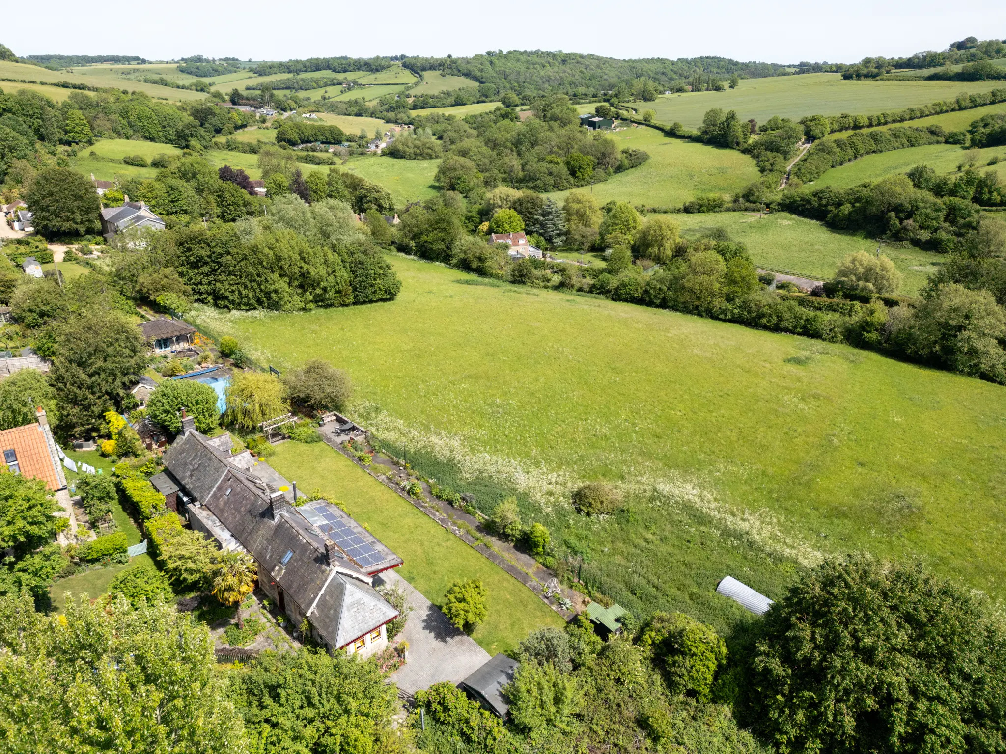
The Old Station in Wellow is a stunning example of a sympathetic railway conversion. The original station building, constructed from local Bath stone, has been thoughtfully extended and adapted into a spacious family home while retaining its linear form and many period features. The property sits on what was once the platform and trackbed of the Somerset and Dorset Joint Railway, a line that closed in 1966 as part of the Beeching cuts.
From ground level, it's a beautiful stone house with a long garden. From the air, the railway heritage becomes unmistakable. The elongated footprint follows the original platform line. The garden boundaries trace the old trackbed. Even the neighbouring plots reveal the geometry of a working station, with the platform edge still visible as a change in ground level running the full length of the property.
02Why Drone Photography Was the Perfect Gift
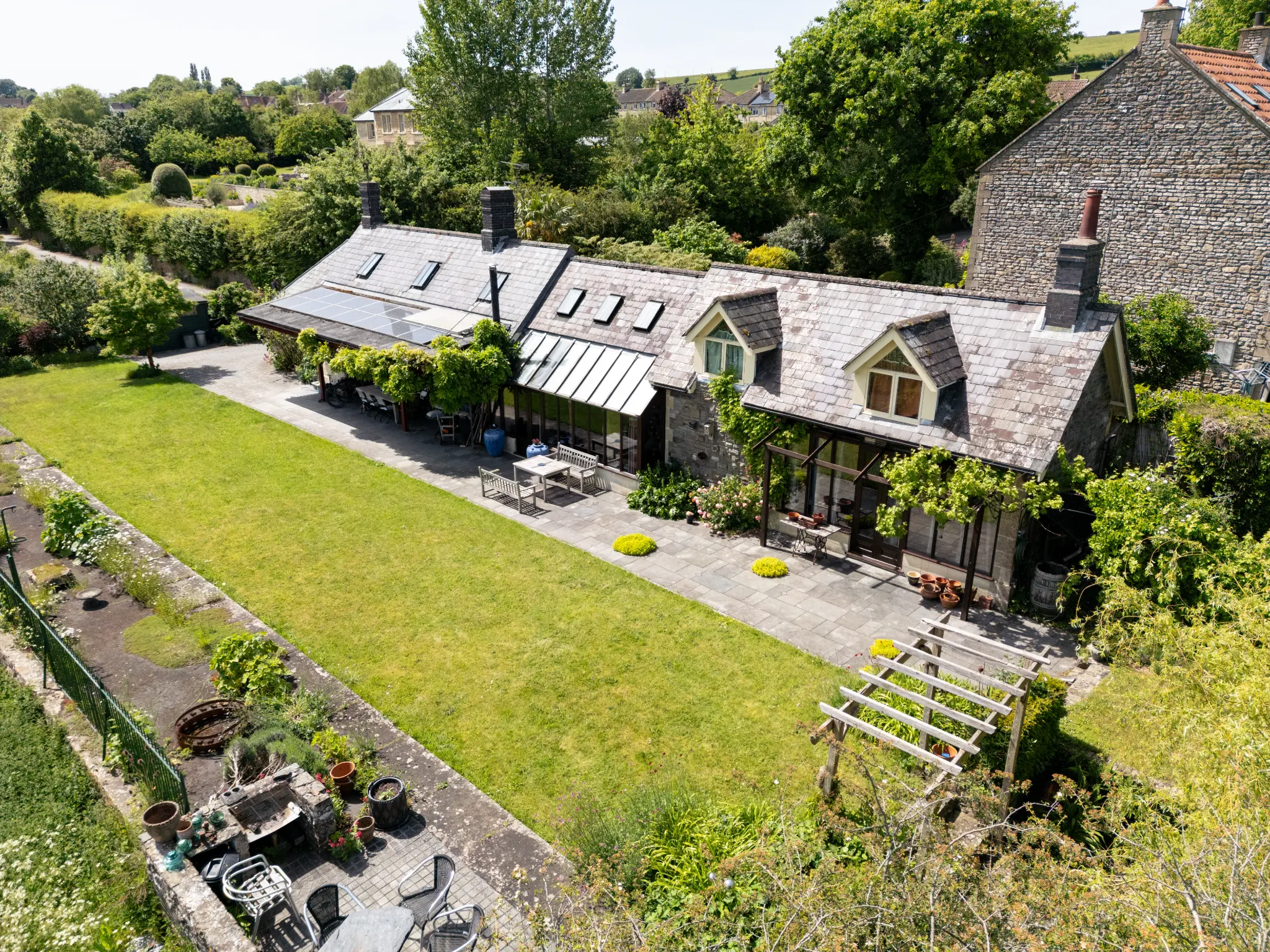
When you live in a home with this much history and character, you see it every day from ground level. You know the garden, the stonework, the way the light falls across the patio. But you never get to see it from above, the perspective that reveals the full story of the building and its railway past.
The owners wanted aerial photographs that would capture their home in a way they'd never seen it before. Something to frame, to share with family, and to keep as a lasting record of this unique place they call home.
The brief required several different types of aerial shot:
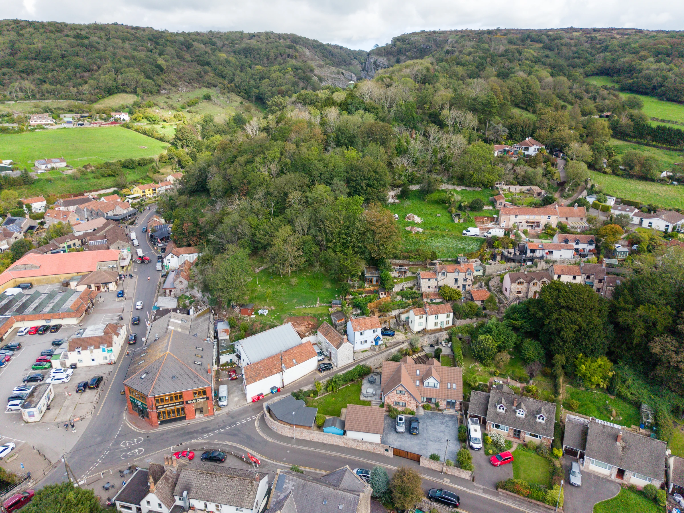
Elevated oblique views showing the building in context with the village and surrounding countryside. These give a sense of the location, the privacy, the views, and the scale of the grounds.
Low-altitude close-ups of the building itself, showing the quality of the stonework, the roof details, the solar panels, the conservatory, and the relationship between the main house and its outbuildings.
Top-down (nadir) shots looking directly downward to reveal the platform outlines and the linear geometry of the property. These are the shots that tell the railway story most clearly.
03The Top-Down Panoramic Stitch
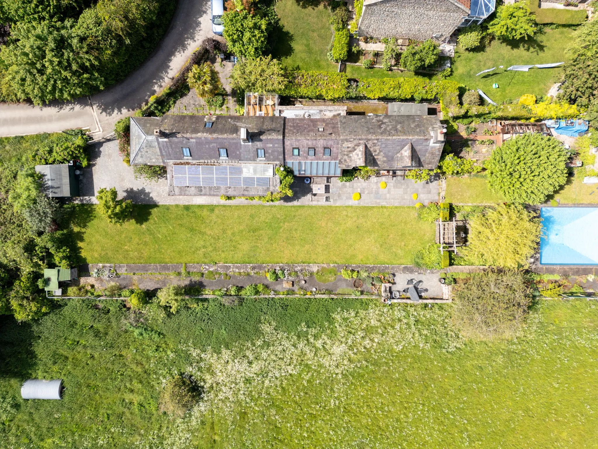
The most technically interesting part of this project was creating a super-high-resolution panoramic image by stitching together multiple top-down drone shots. By flying a series of overlapping passes directly above the property, I captured enough frames to stitch together into a single image that covers the entire site at a resolution far beyond what any single drone photo could achieve.
The result is an image the owners can zoom into and explore in extraordinary detail. You can see individual plants in the garden, the texture of the stonework, the pattern of the paving, and most importantly, the clear line of the original platform edge running along the southern boundary of the garden.
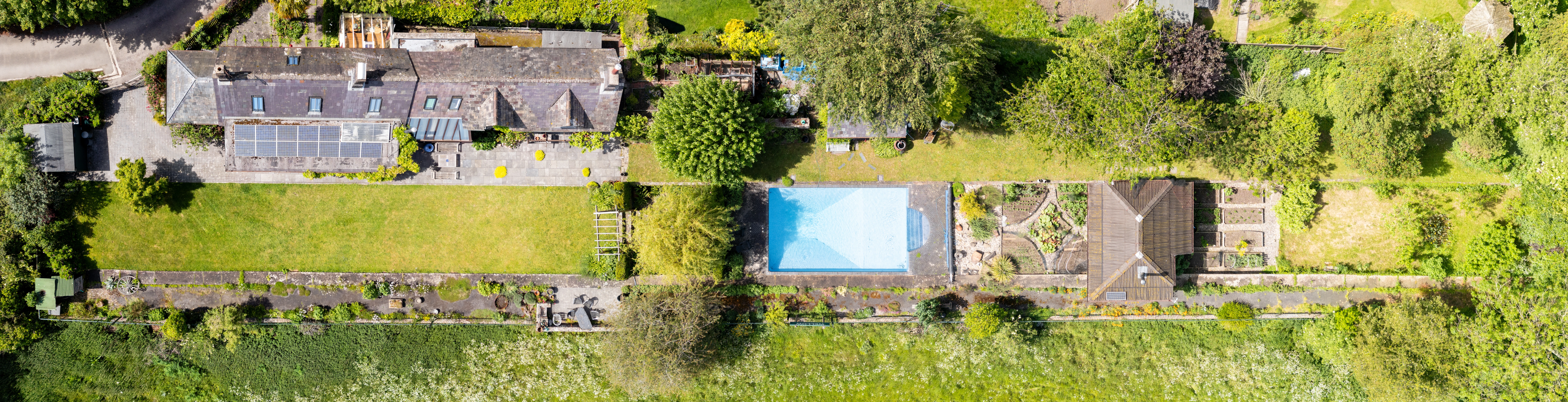
Top-down panoramic stitch of The Old Station, Wellow — 10,000px wide. Scroll to zoom, drag to explore the full resolution.
This kind of stitched panoramic makes a particularly striking print when produced at large format. For the owners, it's a unique piece of art that captures their home in a way no single photograph ever could.
04Capturing the Railway Heritage
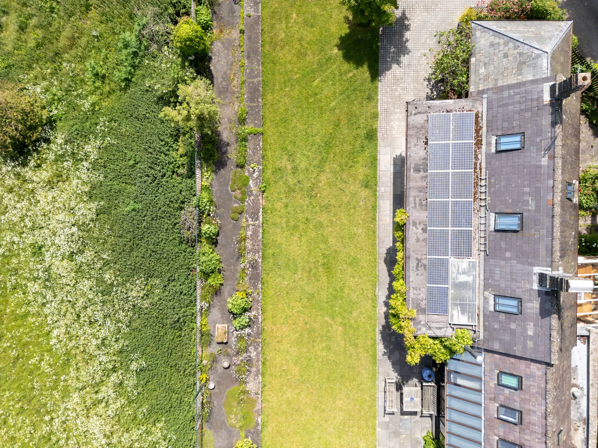
The Somerset and Dorset Joint Railway ran through Wellow from 1874 until 1966. The station served the village for nearly a century, and while the tracks have long since been lifted, the infrastructure left its mark on the landscape. The station building itself is the most obvious remnant, but from the air you can trace the entire railway corridor through the village.
The drone photography reveals details that are impossible to appreciate from the ground:
- The long, straight southern boundary of the garden follows the platform edge exactly
- The change in ground level between the garden and the field beyond marks where the platform once stood
- The linear arrangement of outbuildings and garden structures echoes the railway's geometry
- The old track bed itself has been beautifully repurposed as a garden boundary, its straight edge now defining the lawn rather than guiding locomotives
For the owners, seeing these details from above for the first time was a genuinely emotional experience. They knew the history of their home, but they'd never seen it laid out so clearly from this perspective.
05The Oblique Perspectives
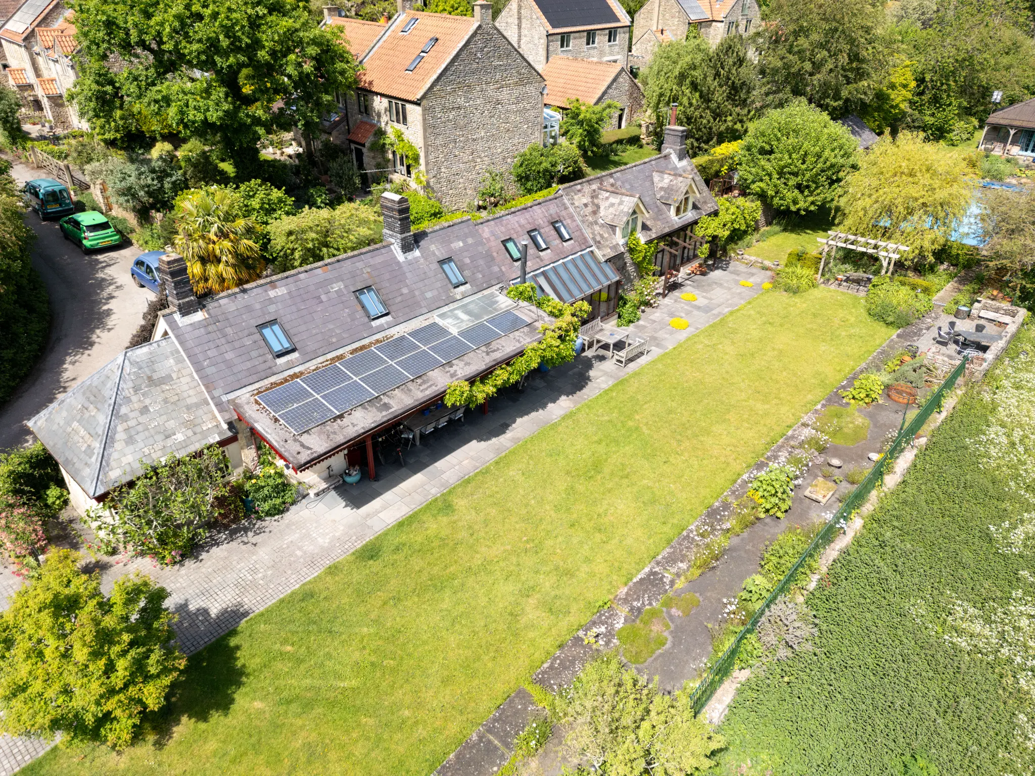
Not every shot was top-down. The oblique angles, taken at roughly 45 degrees from an altitude of 30-40 metres, serve a different purpose. They show the property as a three-dimensional space rather than a flat plan. You can see the roof pitch, the dormer windows, the height of the boundary walls, and the way the garden steps down from the house toward the old trackbed.
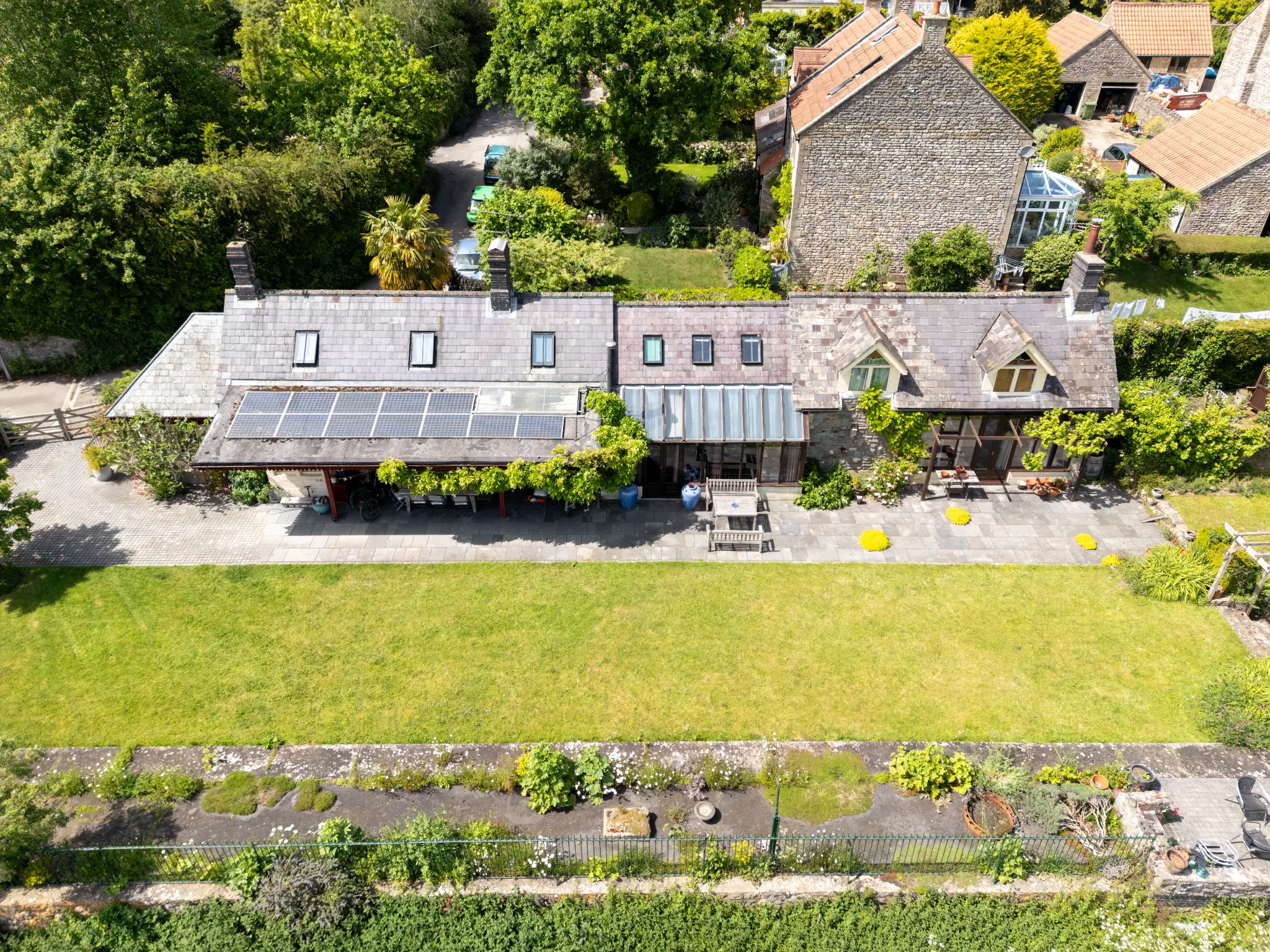
These elevated perspectives capture something that's difficult to appreciate when you're standing in the garden: the sense of space and privacy. The Old Station sits at the edge of the village with open countryside beyond. The drone shows exactly how much green space surrounds the property and how far the views extend. For the owners, these shots are a reminder of just how special their setting is.
06Technical Approach
This project was shot using a DJI drone in a variety of conditions throughout the session. For the top-down stitched panoramic, I flew a systematic grid pattern at a consistent altitude, ensuring at least 30% overlap between adjacent frames. The individual images were then aligned and blended in post-production to create a seamless, distortion-free composite.
All flights were conducted in compliance with CAA regulations, with appropriate permissions and risk assessments in place. The property's location in Wellow, away from any controlled airspace or flight restriction zones, made it straightforward to operate safely.
| Shot Type | Purpose | Altitude |
|---|---|---|
| Wide establishing | Context, location, countryside setting | 80-100m |
| Oblique close-up | Building detail, roof, garden layout | 30-40m |
| Top-down (nadir) | Platform outlines, property boundary | 50-60m |
| Panoramic stitch | Ultra-high-res explorable overview | 50m (grid pattern) |
07Drone Photography as a Personal Commission
Not every drone project is about selling a property. Sometimes it's about capturing a home you love from a perspective you'd never normally see. For the owners of The Old Station, this was about celebrating their home and its history, creating images they can frame, share, and keep for years to come.
This kind of personal commission works particularly well for:
- Converted buildings with unusual footprints (stations, chapels, barns)
- Properties with extensive grounds or land
- Homes where the setting and context are part of what makes them special
- Heritage properties where the historical layout is visible from above
- Milestone moments: moving in, completing a renovation, or simply wanting to capture your home at its best
08Interested in Aerial Photography of Your Home?
Whether you're selling, letting, or simply want a set of stunning aerial images of your home to keep, get in touch for a free quote. I'm CAA licensed and cover Somerset, Bath, Bristol, and nationwide projects with travel included in the price.
Related: Drone photography for property: what you need to know | UK drone regulations guide
UK Drone Restricted Zones Map
This is a rough guide only showing 138 of the major restricted zones across the UK. It does not include every no-fly zone, there are many more local restrictions, temporary NOTAMs, and event-specific zones that aren't shown here. For the full and most up-to-date picture, I'd recommend checking NoFlyDrones.co.uk and the official NATS restriction zone map before every flight.
This is a rough guide only. This map shows the major restricted zones but it doesn't include everything, there are hundreds of smaller restrictions, temporary NOTAMs, Temporary Danger Areas, and event-specific zones that aren't shown here. The boundaries shown are approximate circles; in reality, many FRZs are elongated along runway centrelines.
Always check official sources before you fly. I'd recommend NoFlyDrones.co.uk for a comprehensive interactive map, the NATS restriction zone map for official FRZ data, and the Drone Safety Map by Altitude Angel. Since January 2024, all closed prisons and young offender institutions in England and Wales also have 400m drone restricted airspace.